Good News From Space
In data science, it’s typical to add up many small pieces of information in order to zoom out and understand larger trends. Still, it’s not often that the “bigger picture” is visible (literally) from space. Through my role as an embedded specialist with USAID’s Program Cycle Mechanism, I recently had the opportunity to travel to Niger to investigate a remarkably encouraging set of satellite imagery. These images showed areas in the Sahel region—one of the world’s driest and most vulnerable places—becoming increasingly green.
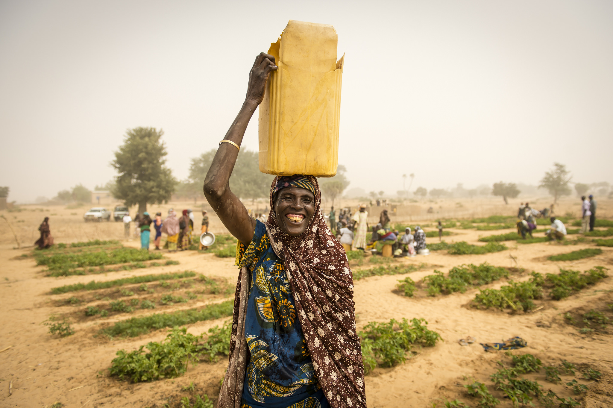
Increased greening is a proxy metric for increased agricultural yield and land productivity, a key intended outcome of the World Food Programme’s (WFP) USAID-funded integrated resilience program in Niger. An important component of this integrated resilience program, which has been implemented in a series of cohorts, includes providing cash and food transfers to local communities as payment for natural land rehabilitation work. The first cohort began in 2014 and showed promising results in conventional monitoring and evaluation (M&E) assessments. Five years later, WFP and USAID wound down initial cohorts while expanding the program into many other communities. This provided a unique opportunity to directly leverage learning from the closed programs for improvements to ongoing and upcoming programming.
In the following years, as the satellite imagery continued to look promising, key questions remained: did the greening trends correspond with improved outcomes for participants? And, did the on the ground evidence systems accurately monitor these benefits?
Building Evidence Systems to Improve Future Programming
As outlined in USAID’s new Policy Framework, harnessing the power of geospatial data is key to driving the development sector’s progress with evidence. The combination of long-term programming and expected large-scale greening through WFP’s resilience programs was an immediate fit for a geospatial analysis project. Through the joint USAID-NASA SERVIR project, I collaborated with the team to design and execute a novel analysis of the satellite data. In many ways this study was a development researcher’s dream: we had over a decade of publicly available satellite imagery, a built-in control group of non-intervention sites, and a three-year post-intervention window to assess sustainability.
As a PCM Specialist, I was fortunate to contribute to the USAID-NASA study from inception to publication in the journal Scientific Reports. A few of the contributions I made included improving the identification of comparison sites and designing a top-line aggregated result graphic. Outside of the analysis, I worked to understand how WFP’s existing M&E approaches align with industry best practices and complement the geospatial data. Over the course of three weeks, a team of USAID technical staff and I visited 13 of the 2,000 villages in Niger that participated in the program, conducting interviews with M&E Officers, government partners, WFP staff, and program beneficiaries. Paired with an extensive desk review of historical documents, these interviews provided critical human context to the many successes and challenges of the program.
We found that not only did the program likely significantly increase agricultural yield in intervention areas, but also that these benefits appear to have been sustained for each of the three post-intervention years available. By complementing remote sensing techniques with traditional M&E systems, we were able to capture a more complete picture of the program’s unique success points.
Multiple Benefits of Land Rehabilitation
It is easy and perhaps reasonable to be overwhelmed by the enormity of the climate crisis, but across the world communities are adapting to and innovating in the face of this new reality. It’s also worth remembering that systems change is fractal: investing in the small land rehabilitation plots, for example, produced multiple and expanding benefits, with communities reporting the return of many native plants and animal species, household income diversification, and reduced desertification, in addition to the increased greenness. By studying successful programs like the WFP/USAID land rehabilitation program, we can better understand the elements of success and replicate them in the future—encouraging the bigger picture to become greener and greener.